
Prague Stories · Lost landscapes
The Lost St John Rapids: The Vltava Adventure That Disappeared Under a Reservoir
Before dams reshaped the Vltava south of Prague, the Svatojánské proudy — St John Rapids — were a dangerous, celebrated river landscape. Today the water is calmer, but trails and surviving traces let you walk through a geography that no longer exists.
Štěchovice / Vltava south of Prague

The Vltava once had rapids famous enough to become an excursion. Then the river landscape disappeared under deeper water.
The river used to behave differently
The stretch known as the St John Rapids was a difficult part of the Vltava for raftsmen and river traffic. Rocks, current and a narrow valley created a landscape remembered for danger as well as beauty.
Tourism arrived before the landscape vanished
The area became associated with early Czech hiking and excursion culture. Prague City Tourism now explicitly frames walks here as routes through a “lost Vltava,” following traces of the vanished rapids and an early Czech tourist trail.
Dams changed what the word river meant
Hydroelectric and reservoir construction raised the water level and submerged the old rapids. Today’s corridor is not simply the same Vltava made safer. Its earlier geometry — rough water, exposed rock and difficult passages — now has to be rebuilt from maps, photographs and fragments of landscape.
The missing landscape survives in photographs
Historic photographs of rough water, rafts and exposed rock can be set against today’s reservoir surface. The contrast makes the scale of change immediately visible: infrastructure did not simply add a dam; it erased a river landscape that people once travelled through and came to see.
Tourism survived, but the attraction changed
The rapids had been both hazard and spectacle, part of rafting history and early excursion culture. When dams remade the valley, visitors did not disappear; they inherited a different river. Reservoir viewpoints and commemorative trails now occupy a landscape where the defining water movement has vanished.
Bring an old photograph
This is one of those places where an archival image can change what you see in front of you. Put rough water, rafts and exposed rock beside today’s calm surface and the engineering becomes visible at once. Without that comparison, it is easy to mistake the present tranquillity for something timeless.
Reviewed visuals
See the story
Supporting images selected in the Prague Stories visual review. Context images are labeled so they are not mistaken for documentary proof of the exact subject.
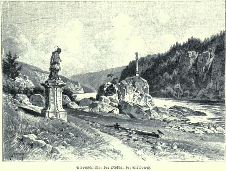
1896 historical depiction of the St John Rapids before inundation.
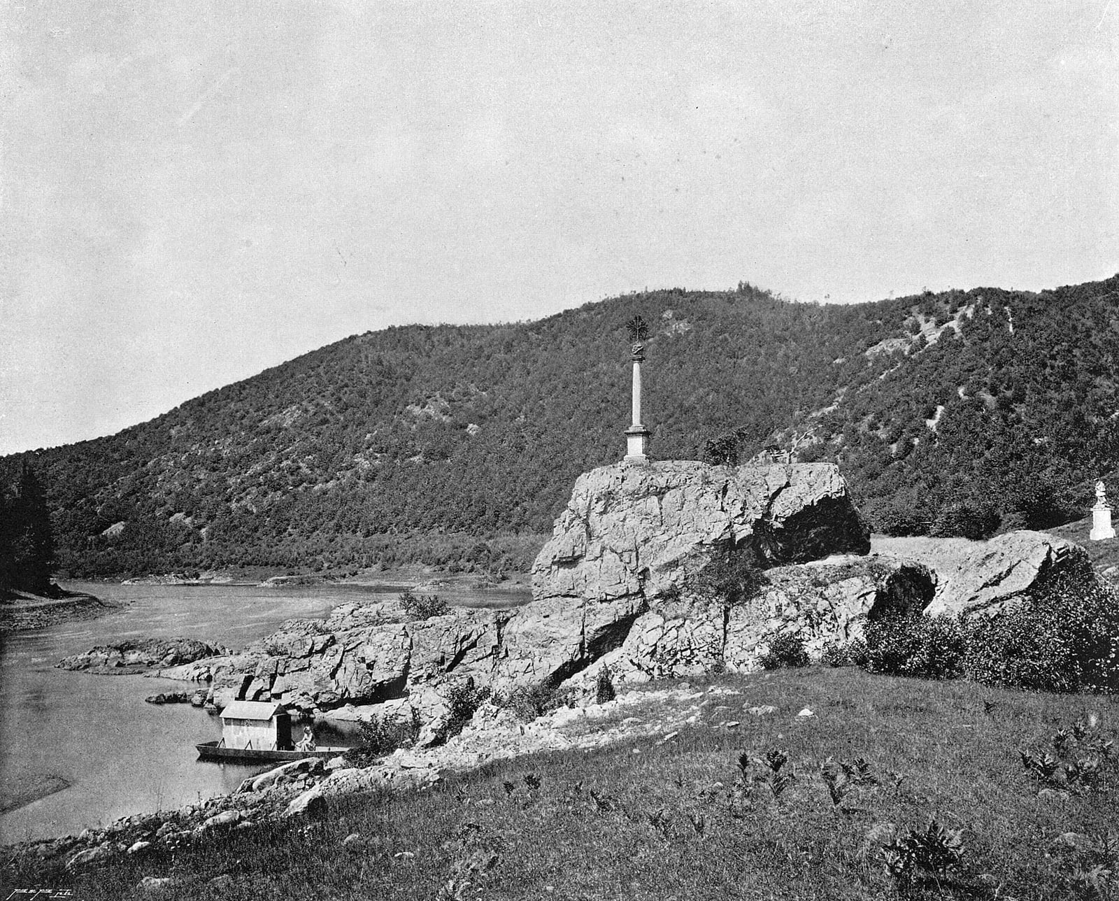
Late-19th-century photograph/print by Jindřich Eckert showing the rapids and river landscape.
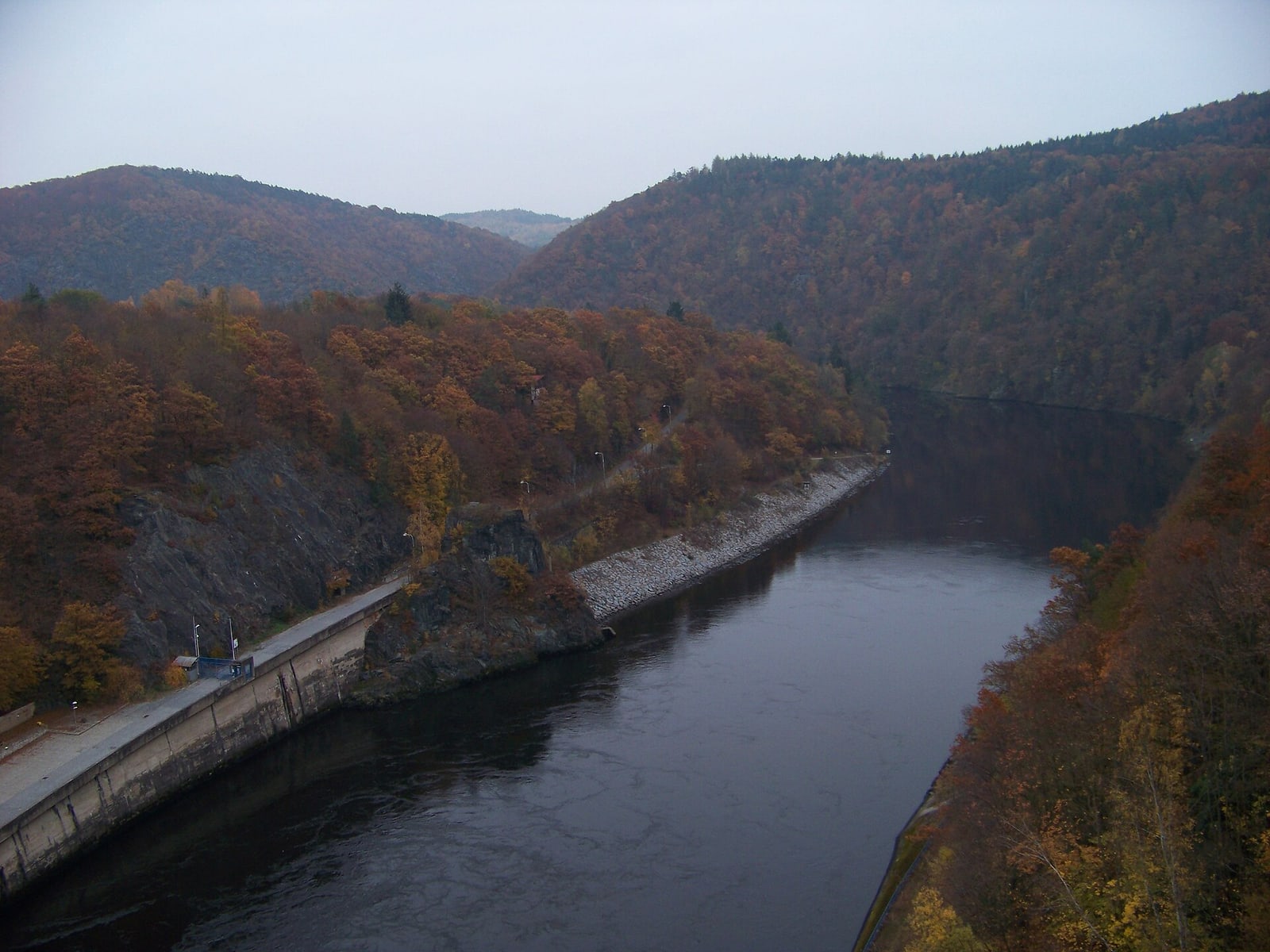
Modern view of the reservoir area where the former rapids were submerged.
Quick facts
- The Svatojánské proudy were a historically difficult rapids section of the Vltava.
- The landscape became an important excursion and hiking area.
- Reservoir construction submerged the old rapids.
- Modern trails preserve access to parts of the former river landscape.
Questions
Can you still see the rapids?
No. The original rapids were submerged after dam construction.
Can you hike the area?
Yes, but route difficulty and current access should be checked before travel.
Why were the rapids called St John?
The name is connected with St John of Nepomuk and the river tradition around him.
Sources & further reading
- Ztracená Vltava: Cesta Svatojánských proudů — Prague City Tourism